Charles Street Development
Development along Charles Street – the Eastern boundary of Tuscany-Canterbury
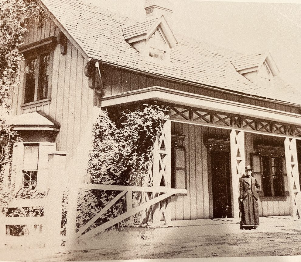
Charles Street changed from a street of huge homes with wraparound porches with stables and garages in the back, to one of high-rise apartment buildings. People moved from the downtown with its congestion, noise, and foul air to the pleasures of the “suburbs” in 1927.
Charles Street had modest beginnings. When “Baltimore Town” was laid was in 1730, Charles Street was first known as Forrest Street. It led North from the harbor “toward and through woodlands and farms: to the great forest that still surrounded the fledgling city.
1800's
By the 1800’s the name changed to Charles Street. The street grew with the city, extending north of Merryman’s Lane by 1854. It was paved with cobblestones, wooden blocks, granite blocks, and asphalt blocks until the 1920’s when it was covered with smooth asphalt. All the Charles Street homes had big yards that went all the way to Canterbury Road. City water was not available in this era so the houses had artesian wells and cisterns. There were stables in the back yards and everyone had a horse and carriage. One house had a cow. The street lights were gas and the lamplighter would light each lamp daily. By the 1920’s most of the homes had cars.
Between the two world wars and afterward, the Charles Street estates, built in the 1880’s, disappeared. Their grandiose designs may have contributed to their demise. Many had large rooms with high ceilings and inadequate insulation to withstand the cold winters. In the critical depression years of the 1930’s, the cost of heating the large houses with coal became exorbitant. Families who wished to sell were often unable to find a buyer. The large estates were sold, and the homes became apartment buildings, some eventually becoming condominiums during the 20th century.
The back parts of their lots were sold to George Morris who built the University homes on Canterbury and Cloverhill Roads. There was a twenty foot drop between the homes on Charles Street and the Cloverhill alley, hence a retaining wall had to be built.
The West side of Charles Street today is zoned R10 and is considered “high density” residential zoning. R10 is the largest Residential Zoning District with the highest floor area ratios. It typically has large multifamily buildings including high rise residential towers. Multi-family housing of 217.8 units per acre are allowed.